
Video Safety & Dash Cams
Collision Reconstruction in Geotab: Reading the Seconds Before and After an Impact
The GO device's accelerometer records a collision in detail the driver cannot: speed, braking, direction and force, before, during and after impact. Collision Reconstruction presents that record as a report — point of impact, speed profile, acceleration curves — that an insurer, a lawyer or a safety manager can read without an engineer.
What the Device Records
Every GO device carries a three-axis accelerometer sampling many times a second. In normal driving it feeds the harsh braking and cornering events on the driver scorecard. When it senses forces consistent with a collision it switches to high-resolution logging, capturing the seconds before and after at full detail and flagging the event to the platform. The raw record is a set of curves: forward and lateral acceleration, speed, and heading, with GPS position, stamped to the fraction of a second.
What the Add-In Makes of It
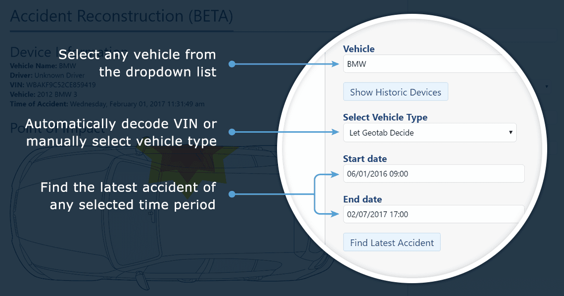
Collision Reconstruction reads that record and produces a report: the moment and direction of impact, the vehicle's speed at impact and in the seconds before, whether and when the brakes were applied, the deceleration profile, and the vehicle's movement after. It draws the sequence on the map and as charts, and states the findings in plain terms — 'vehicle travelling at 47 km/h, braking began 1.8 seconds before impact, impact from the front-left' — so the reader does not have to interpret the curves themselves.
Who Reads It
The insurer, first: a report that shows the fleet's truck was stationary when struck, or braking hard before a car pulled out, changes how a claim is assigned. Lawyers in the litigation that follows a serious collision. The fleet's safety manager, reconstructing what happened for the internal review and the coaching conversation. And, paired with a camera, the report sits beside the video, so the numbers and the picture confirm each other.
Setup
The add-in reads the accelerometer data the GO device already records; there is no additional hardware. It is installed from the Marketplace into the fleet's database and produces a report for any collision-flagged event. High Point GPS deploys it alongside camera systems for fleets in Quebec, Ontario and the northeastern US.
Frequently asked questions
What is Collision Reconstruction?
A Marketplace add-in that turns the GO device's high-resolution accelerometer record of a collision into a report showing point of impact, speed and braking before impact, and movement after.
Does it need a camera?
No. It works from the accelerometer and GPS data. With a camera, the report and the video sit together.
How accurate is the speed at impact?
It comes from the device's own GPS and engine data sampled many times a second, and is the same record used for the driver scorecard.
Can it be used in a claim or a lawsuit?
Yes. The report is routinely provided to insurers and used in litigation as part of the telematics record.
Does it record every trip at high resolution?
No. The device logs normally and switches to high-resolution capture when it senses a collision.
Related solutions & products
Continue reading
- Dash Cams & AI Video Safety overview →
- Dash Cams for Trucks, Front and Rear: What Each Camera Position Sees →
- Fleet Dash Cams With Live View: What Live Streaming Shows and When It Is Actually Used →
- What Is ADAS? Advanced Driver Assistance Systems in Fleet Vehicles and Dash Cams →
- Does Geotab Record Audio or Video? What the GO Device Captures →
- More in Video Safety & Dash Cams →
Get a free quote
What are you looking for?