
Industry
GPS Fleet Tracking for Mining, Quarries & Aggregates
GPS tracking for quarry, pit and mine fleets that counts haul cycles from the face to the crusher, keeps loaders, haul trucks and highway trucks on one map, enforces site speed and exclusion zones, and maintains machines on the engine hours they actually work.
Updated September 21, 2026
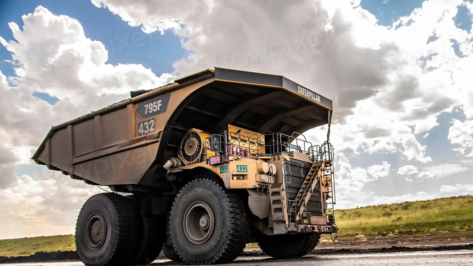
A quarry or aggregate operation runs two fleets that rarely meet: the loaders, haul trucks and water trucks inside the pit, and the highway trucks that carry the product to the customer. GPS tracking for mining and aggregates puts both on one live map for the site office, so the dispatcher sees the loader at the face, the haul trucks cycling to the crusher and the highway trucks at the scale, and the day's production is counted from the trucks rather than tallied at the end of the shift. Geofences around the face, the crusher, the stockpiles and the scale turn each truck's movement into cycles, with the load and dump time per cycle, and the count at the end of the shift is the number the site manager and the customer's ticket agree on. Site speed limits, haul-road rules and exclusion zones around the blast area are enforced as rules that alert the supervisor and score the operator. The Geotab GO device reads engine hours and, on machines that report it, the CAN bus, so maintenance is scheduled on the hours a loader or a haul truck actually works and fault codes reach the shop as they are logged. Electronic pre-shift inspections replace the paper form the regulator asks to see, and the highway trucks carry ELD hours of service and IFTA distance reporting on the same platform for the drivers and routes that need them.
Common challenges
- Production counted by a clipboard at the crusher, with haul cycles estimated rather than measured
- Site speed limits and blast-area exclusion zones posted but unenforced until an inspector or an incident
- Loaders and haul trucks maintained on the calendar while engine hours accumulate through double shifts
- Pre-shift inspections on paper that the regulator asks for and the site cannot always find
- Highway trucks and pit machines on different systems, or on none, so the site office has no single picture
- Fuel burned at idle by machines waiting at the face or the crusher, with nobody measuring it
How High Point GPS helps
- Live location of loaders, haul trucks, water trucks, graders and highway trucks on one map for the site office
- Haul-cycle counting from geofences around the face, the crusher, the stockpiles and the scale, with load and dump time per cycle
- Site speed limits and haul-road rules enforced as geofence rules, with alerts to the supervisor and events in the operator's score
- Exclusion zones around the blast area and the highwall that alert when a machine or a vehicle enters
- Engine-hours maintenance reminders and CAN bus fault codes from the machines that report them
- Electronic pre-shift inspections in the Geotab Drive app with the machine-specific checklist, kept for the regulator
- Idling and fuel reports per machine and per zone, showing where the diesel goes when nothing is moving
- ELD hours of service and IFTA distance reporting for the highway trucks, on the same platform as the pit
Counting Cycles From the Trucks
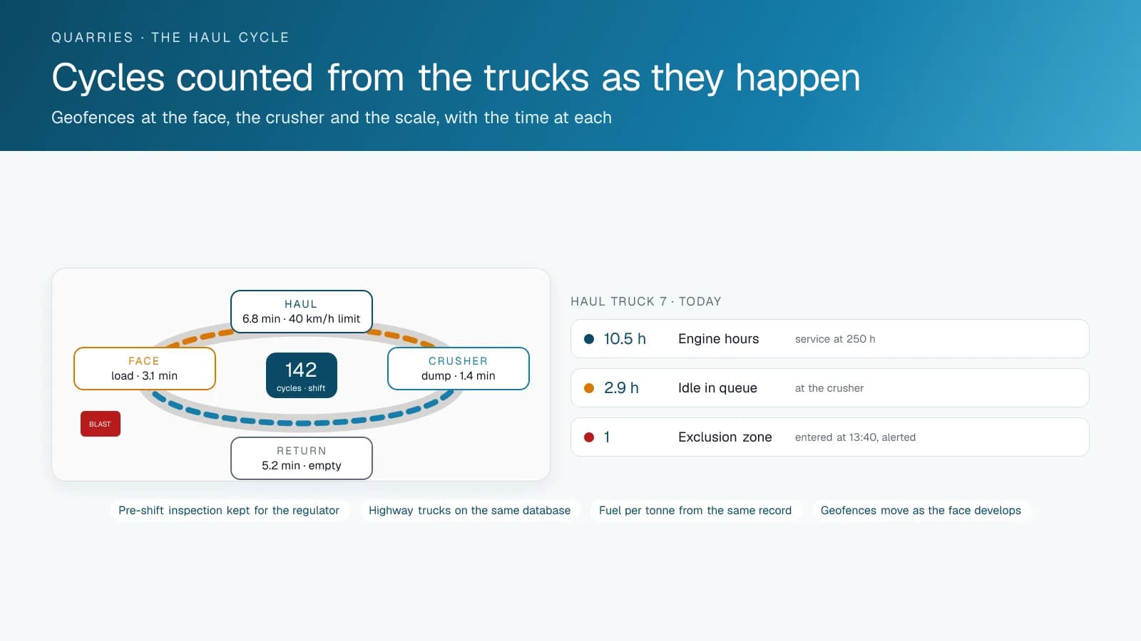
A haul cycle is the unit of production in a pit: the truck loads at the face, hauls to the crusher or the stockpile, dumps and returns. With a geofence around each of those points, the platform counts the cycles as the trucks make them, with the time at the face, the haul time, the time at the crusher and the return for each one. The site manager sees the shift's production on the map while it is happening, and the count at the end of the day is a record rather than a tally.
The same cycle records show where the time goes. A loader waiting for trucks, trucks queued at the crusher, a haul road that has slowed since the last grading. High Point GPS builds the cycle reports to the site's own layout and updates the geofences as the face moves, so the record keeps counting as the pit develops.
Speed, Exclusion Zones and the Site Rules
Every site has a speed limit on the haul road and a lower one near the crusher and the scale, and every site has an exclusion zone around the blast pattern and the highwall. The platform enforces them as geofence rules: a machine or a vehicle that exceeds a zone's limit or enters an exclusion zone triggers an alert to the supervisor and an event in the operator's score, with the time and the position in the record. The safety report a regulator or an inspector asks for is a report the platform already produces, and the record of what the site did about each event is beside it.
Visiting highway trucks are the hardest to control on site, because their drivers do not know the rules. A plug-in device or a temporary tag brings a visiting truck onto the map for the duration of its visit, with the same speed and exclusion rules applied, and the site office sees it at the scale and on the haul road like its own machines.
Maintaining Machines on the Hours They Work
A loader that runs two shifts adds engine hours faster than any calendar can track, and a haul truck that queues at the crusher idles through a third of its shift. The GO device reads engine hours from each machine, and on machines that report through the CAN bus, fault codes, fluid temperatures and pressures. Maintenance reminders run on the hours that accumulate, and a fault code reaches the shop as the machine logs it, so a hydraulic or cooling warning at the face is a repair planned for the next break rather than a machine down at the start of a shift.
Idling reports per machine and per zone show where the diesel goes when nothing is moving: the trucks in the crusher queue, the loader waiting for trucks, the water truck running between passes. Fuel-card and bulk-tank integration matches the fuel dispensed to the machine that burned it, and the fuel cost per tonne comes out of the same record as the cycle count.
Inspections, the Regulator and the Highway Fleet
Pre-shift inspection of mobile equipment is a regulatory requirement in every mining jurisdiction, and the paper form is the one most likely to be missing when the inspector asks. Electronic inspections in the Geotab Drive app walk the operator through the machine-specific checklist, time-stamp each item and route a defect to the shop before the machine goes to work. The records are kept for as long as the regulator requires and produced in seconds.
The highway trucks that carry the product carry their own compliance. The drivers and trucks that fall under the ELD mandate log hours of service in the same app, IFTA distance by jurisdiction is reported from the same trip records for the trucks that cross state or provincial lines, and the delivery ticket's arrival at the customer's site is a geofence record like every other. One MyGeotab database holds the pit and the highway fleet, and the site office sees both.
Frequently asked questions
Does it work on loaders and haul trucks, not just highway trucks?
Yes. High Point GPS installs the GO device on loaders, haul trucks, graders and water trucks with a harness suited to the machine, reading position, engine hours and, where the machine supports it, CAN bus data and fault codes. The GO RUGGED version is used where the cab is open or the environment demands it.
How does haul-cycle counting work?
Geofences around the face, the crusher, the stockpiles and the scale record each truck's movement between them as a cycle, with the time at each point. The site sees production on the map during the shift, and High Point GPS moves the geofences as the face develops.
Can it enforce exclusion zones around the blast area?
Yes. An exclusion zone is a geofence with an entry rule, so a machine or a vehicle that enters it triggers an alert to the supervisor and a record with the time and the position. The same applies to the highwall and any other restricted area.
Does it work where there is no cell coverage in the pit?
The GO device stores its data while out of coverage and uploads it when the machine returns to range, so the cycle and inspection records are complete. Sites with no coverage at the face can add a private network or satellite-connected devices where live position is needed.
Can the highway trucks be on the same system?
Yes. One MyGeotab database holds the pit machines and the highway fleet, with ELD hours of service and IFTA distance reporting for the trucks that need them, and the site office sees both fleets on one map.
Related solutions
Related guides
- Fleet Maintenance: Engine Hours vs. the Calendar →
- Construction Asset Tracking Software: Equipment, Attachments, Materials and Tools in One System →
- How Geofencing Works for Fleet Tracking →
- What Is a Geotab IOX and What Does It Do? →
- What Is IFTA? Fuel Tax Reporting Explained →
- Geotab DVIR: How Digital Vehicle Inspection Reports Work →
Get a free quote
What are you looking for?