
Industry
GPS Fleet Tracking for Emergency Management & Disaster Response
GPS fleet tracking for emergency management and disaster response: every truck, trailer and generator on one map, with records for reimbursement.
Updated September 21, 2026
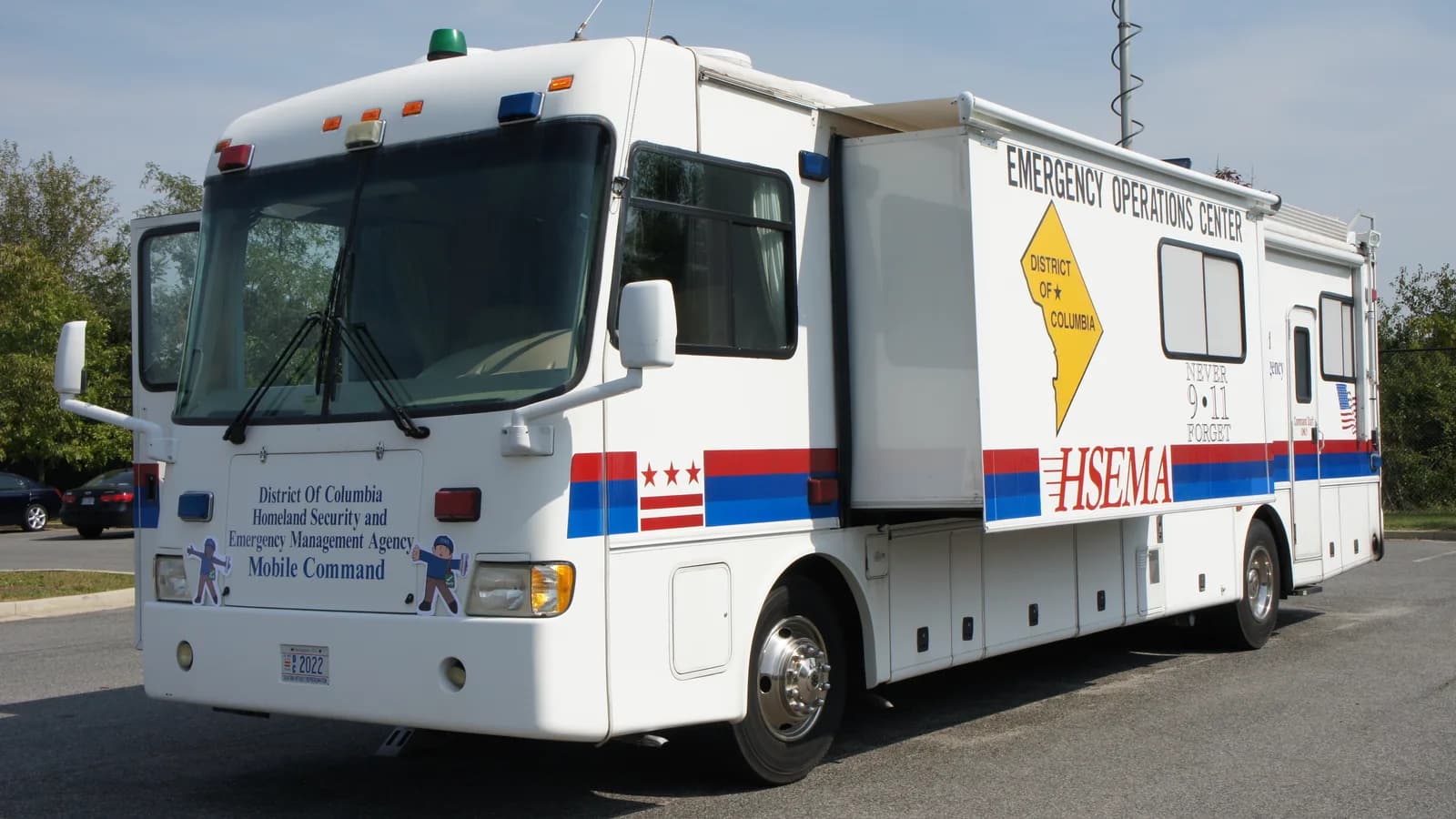
An emergency operations centre runs on one question: what do we have, and where is it? During a flood, an ice storm or a wildfire evacuation, the answer changes by the hour, and the radio log rarely keeps up. GPS tracking from High Point GPS puts every response vehicle, trailer and piece of powered equipment on one live map for the operations centre. Beside each unit are the staging area it left, the site it is at and the time it arrived. A GPS tracking device in each truck reports position, engine hours and fault codes; battery-powered trackers and Bluetooth asset tags follow the generators, pumps and light towers that ride on trailers and get dropped at a site for days. Geofences around staging areas, shelters and work zones produce arrival and departure records without anyone writing them down. When the event ends, the reimbursement claim and the after-action review are built from the same trip and engine-hours records rather than reconstructed from memory. Coverage drops in a disaster area; the GPS tracking device stores trips offline and uploads them when the network returns, and nothing is lost. Mutual-aid partners and contractors can be tracked in the same High Point GPS platform database for the length of the deployment, with access removed when they demobilize. Driver-behaviour reporting keeps emergency driving within the agency's policy, and electronic inspections in the driver app confirm each unit was checked before it rolled out.
Common challenges
- An operations centre that knows what was dispatched but not where it is now, once the radio log falls behind
- Generators, pumps and light towers dropped at sites for days with no record of which site or for how long
- Reimbursement claims rebuilt weeks later from memory, fuel receipts and a stack of paper trip sheets
- Cellular coverage that drops exactly where the response is happening
- Mutual-aid and contractor vehicles working under the agency's command with no visibility for the operations centre
- Emergency driving with no record of speed and route when a collision or a complaint follows a response
How High Point GPS helps
- Every response vehicle on one live map for the operations centre, with the staging area it left and the site it reached
- Battery-powered trackers and Bluetooth asset tags on generators, pumps, light towers and trailers that sit at a site for days
- Geofence arrival and departure records for staging areas, shelters and work zones, without radio check-ins
- Trips stored on the GPS tracking device when coverage drops and uploaded when the network returns
- Engine hours and mileage per unit per deployment, exported for reimbursement claims and after-action reports
- Temporary the High Point GPS platform access for mutual-aid partners and contractors, removed when they demobilize
- Driver-behaviour and speed reporting held to the agency's emergency-driving policy, with dash cam video for incidents
- Electronic pre-deployment inspections in the driver app and fault codes sent to the shop from the field
One map for the operations centre
The first hours of an event are the ones when the operations centre most needs to know where its resources are and least has time to ask. With every vehicle and trailer on one live map, the person running the resource board sees which trucks have reached the staging area, which are still on the highway and which are already at a site. Geofences drawn around staging areas, shelters and work zones log each arrival and departure automatically, and a zone rule can alert the centre when a unit leaves a site it was assigned to. High Point GPS builds those zones before the season starts, and the map is ready the day the event is declared.
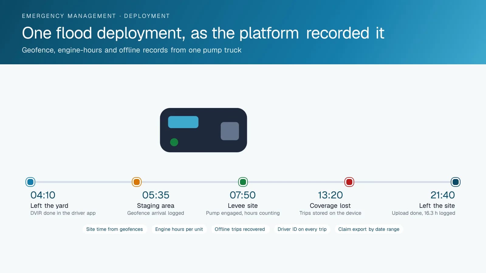
Coverage in a disaster area is unreliable, and a tracking system that goes blind when the towers do is not much use. The GPS tracking device records every trip, stop and engine event on the device itself and uploads the backlog the moment a connection returns. The operations centre sees a gap in live position for the hours the unit was out of coverage, then the full route fills in. For the after-action review, the record is complete: where each unit went, how long it sat at each site, when it left and who was driving it. Nothing depends on a radio operator having written it down.
Tracking the generators, pumps and trailers
Much of what a response agency deploys has no engine of its own or sits switched off for most of the day. A generator on a trailer, a portable pump, a light tower in a shelter parking lot: each leaves the yard on a truck and stays behind when the truck goes back. Battery-powered trackers report the position of trailers and skid-mounted equipment for months on a charge, and Bluetooth asset tags on smaller items are read by any GPS tracking device that passes nearby. The result is a site-by-site inventory that updates itself, with the arrival time of each piece recorded by the geofence it entered.
When a generator has been running at a shelter for six days, its engine hours matter twice: once for the service interval and once for the claim. A GPS tracking device or a powered tracker on the generator reports hours and fault codes, and the High Point GPS platform lists each unit's hours per site per deployment. At demobilization, the map shows what is still out there and where, which is the difference between recovering the equipment in a day and finding it in a ditch in the spring. Equipment lent to a neighbouring municipality stays on the map until it comes home.
Records that survive the audit
Reimbursement programs and municipal auditors ask the same questions: which unit worked, where, for how many hours, and who drove it. Trip records give the mileage and route for every vehicle by day. Engine-hours reports give the operating time for every powered unit. Geofence records give the time at each site. Driver ID from an IOX-NFCREADERA tag ties each trip to the operator, including seconded staff and mutual-aid crews who tapped in on a borrowed truck. High Point GPS sets up an export that matches the claim form's structure, and the finance office runs it once instead of reconciling trip sheets for a month.
The same records answer the harder questions. A resident says a plow damaged their fence during the storm; the trip replay shows which unit passed and whether it deviated. A mutual-aid partner invoices for 14 hours of pumping; the engine-hours report shows 9. A contractor claims the truck was at the levee all night; the geofence log shows it left at 11:40 pm. None of this requires an argument, because the record was produced by the device rather than by the parties. Disputes are settled by reading a report, not by comparing recollections.
Partners, drivers and the units themselves
A large event brings vehicles from neighbouring municipalities, provincial or state agencies and private contractors under one command. High Point GPS can add those vehicles to the agency's High Point GPS platform database for the deployment, through their own GPS tracking devices or a set of plug-in units kept for the purpose. Permissions show the operations centre the partner's vehicles and nothing more of the partner's own operation. When the partner demobilizes, the access is removed and the deployment record stays with the agency. Contractor trucks working at an hourly rate are tracked the same way, and their invoices are checked against their own trip and hours records.
Emergency driving still has limits. Speed and harsh-event reporting with thresholds set to the agency's policy show who drove hard when it was not warranted, and AI dash cams provide the road-facing video when a response vehicle is involved in a collision. Before a unit leaves the yard, the electronic DVIR in the driver app records the inspection with a time stamp and routes defects to the shop. Fault codes reach the shop from the field, and engine-hours maintenance reminders keep the units that sit idle between events ready for the next one, which is when a dead battery costs the most.
Frequently asked questions
Does tracking work when cellular coverage is down?
Live position needs a network, but the record does not. The GPS tracking device stores trips, stops, engine hours and events on board when coverage drops and uploads everything when a connection returns. The operations centre sees the gap in real time and the full route afterwards. For units that must be seen live in dead zones, High Point GPS can discuss satellite-backed options.
How do we track generators, pumps and trailers that have no power?
Battery-powered trackers report the position of trailers and skid-mounted equipment for months on a single charge, at an interval you choose. Bluetooth asset tags on smaller items are picked up by any tracker-equipped vehicle that passes nearby. Powered generators can carry a GPS tracking device or a tracker that reports engine hours and fault codes as well as location.
Can the records be used for reimbursement claims?
Yes. Mileage per vehicle, engine hours per unit, time inside each site geofence and the driver on each trip are all exported from the High Point GPS platform by date range. High Point GPS configures the report to match the structure of the claim form your agency files, and the finance office runs it after the event rather than reconstructing it from paper.
Can we track mutual-aid and contractor vehicles during an event?
Yes. Partner vehicles are added to your database for the deployment, either through their existing GPS tracking devices with shared access or through plug-in units your agency keeps for that purpose. The operations centre sees them beside its own fleet. When the partner demobilizes, access is removed and the deployment record remains with your agency.
Do we need to install anything in the vehicles?
The GPS tracking device plugs into the vehicle's diagnostic port, and most installs take minutes. Units that carry auxiliary equipment, such as a plow or a pump driven from the truck, can add an IOX-AUXM to record when it is engaged. High Point GPS coordinates installation across the fleet and supplies plug-in units for seasonal or borrowed vehicles.
Related solutions
Related guides
- Fleet Dispatch and Tracking for Public Sector →
- GPS Asset Tags vs. Powered Trackers: Which to Use →
- How Geofencing Works for Fleet Tracking →
- Equipment Theft Recovery: How GPS Gets Stolen Machines and Trailers Back →
- Fleet Maintenance: Engine Hours vs. the Calendar →
- Municipal Fleet Tracking: A Buyer's Guide for Cities, Counties and Public Works →
Get a free quote
What are you looking for?