
Industry
GPS Fleet Tracking for Ambulance & EMS
GPS tracking for ambulance and EMS fleets that measures response time from the bay to the scene, records lights, siren and patient-compartment activity, logs hospital arrival and handoff through geofences, and keeps crew hours and vehicle maintenance ahead of the next call.
Updated September 21, 2026
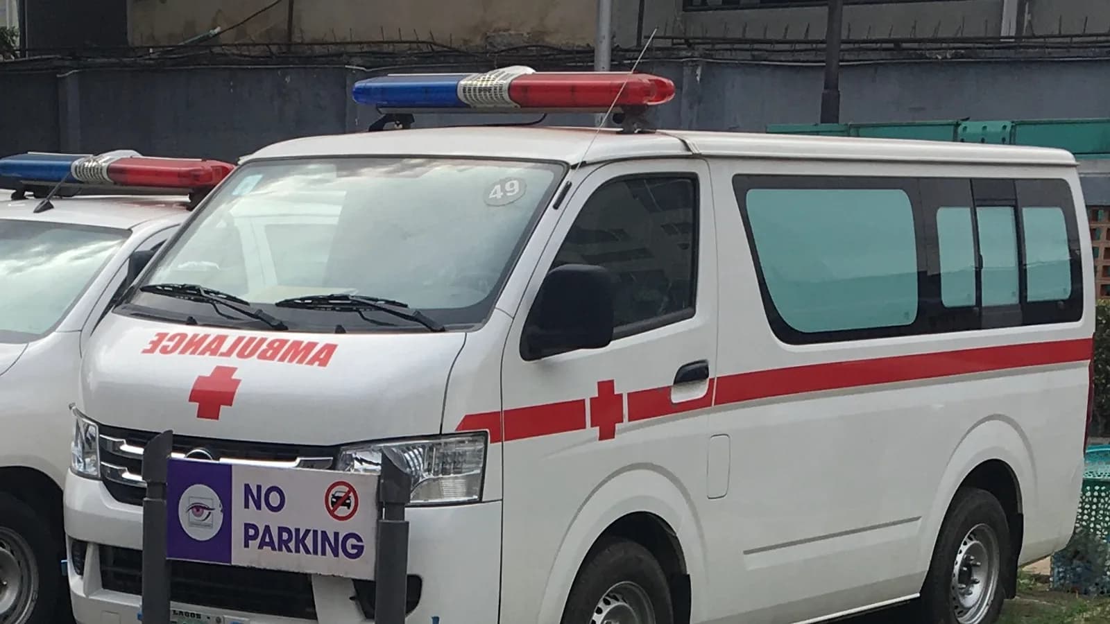
An ambulance service is judged on minutes. The contract with the region or the hospital sets a response-time standard, the medical director reviews the calls that missed it, and every long transport raises the question of what the crew did with the time. GPS tracking for EMS fleets gives the operations centre every unit on one live map and a trip record built for that review: the time the unit left the bay, the time the lights came on, the arrival at the scene, the departure with the patient, the arrival at the hospital and the time the stretcher came out. The Geotab GO device reads the emergency lights, the siren and the patient-compartment circuits through IOX-AUXM auxiliary inputs, and geofences around every emergency department record arrival and handoff without anyone touching a tablet. Driver scoring separates emergency response from routine transfers, and a paramedic's coaching report reflects the driving that policy governs. Hours-of-service tracking in the Geotab Drive app shows a supervisor which crews are approaching their limit before the next call comes in. Maintenance runs on engine hours, because an ambulance idles at scenes and in hospital bays for a large share of its life. High Point GPS builds the MyGeotab database for the service's structure, feeds position to the dispatch system through the open API and keeps the data under the service's control.
Common challenges
- Response-time reporting assembled by hand from dispatch logs and crew notes, with gaps that a contract auditor will find
- No record of when the lights and siren were on, so a speed complaint or a collision review starts with the crew's memory
- Hospital offload delays that cost the service hours a week with no time-stamped record to take to the hospital
- Driver scoring that counts emergency response as bad driving and loses the crews' trust in the first month
- Crews working past a safe number of hours because no one could see the shift totals across the fleet
- Ambulances maintained on mileage while the engine runs for hours at scenes and in bays
How High Point GPS helps
- Live position of every unit with a bay-to-scene and scene-to-hospital timeline generated from the trip record and the auxiliary inputs
- Emergency lights, siren, patient-compartment door and stretcher circuits read through the GO device's IOX-AUXM inputs and stamped on the trip
- Geofences around every emergency department that record arrival, offload wait and departure for the hospital handoff report
- Driver scoring that excludes lights-and-siren segments and reports response driving separately for the medical director
- Crew hours of service in the Geotab Drive app with supervisor alerts as a crew approaches its limit
- Fatigue and distraction detection from a driver-facing AI dash cam, with video pulled by trip and by event
- Maintenance reminders on engine hours and fault codes, with the shop notified before a charging or cooling fault strands a unit
- Vehicle position and status pushed to the CAD or dispatch system through the open API, with the service owning its data
Response Time From the Bay to the Scene, Measured Automatically
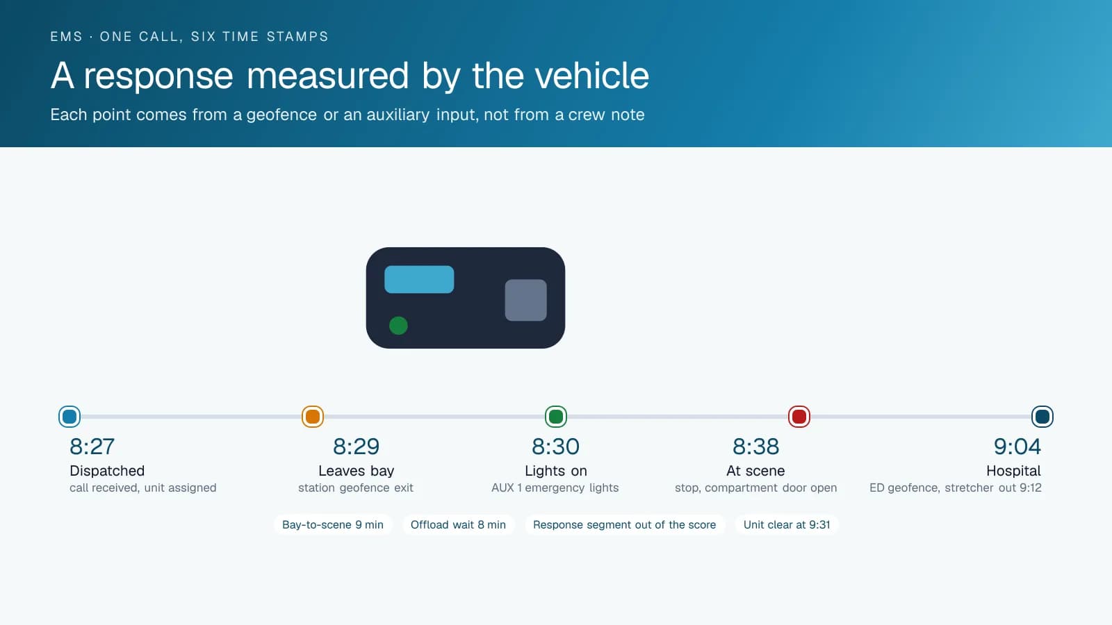
The response-time standard in an EMS contract is measured in minutes and reported in percentiles, and the report is only as good as its time stamps. The trip record fills them in from the vehicle: the unit leaves the station geofence, the emergency lights come on through the AUX input, the unit stops at the scene address, and the patient-compartment door opens. High Point GPS builds those points into a per-call timeline that the operations centre can pull for any unit on any day, and a monthly report that shows the 90th-percentile response by zone and by hour.
The same timeline answers the calls that went wrong. A complaint that a unit took 22 minutes shows a departure four minutes after dispatch and a route through a closure the crew could not have known about. A review of a long scene time shows the compartment door opening and closing three times before departure. The record comes from the vehicle rather than from anyone's recollection, which is what makes it useful to the medical director and to the service's counsel. Retention follows the service's own policy, and a record from two years ago is as easy to pull as one from yesterday.
The Hospital Handoff and the Offload Delay
Offload delay at the emergency department is where an ambulance service loses hours it cannot bill and cannot recover. A geofence around each hospital records the unit's arrival; the stretcher circuit on the AUX input records when the patient came out; the departure from the geofence records when the unit was clear. The gap between arrival and clear is the offload time, and the report shows it by hospital, by hour of day and by day of week. That report is what a service brings to the regional health authority or the hospital when it asks for the delay to be addressed.
The same geofences serve the dispatch side. A unit sitting in a hospital bay for forty minutes is visible to the operations centre as unavailable, and a unit that has just cleared is visible as ready. When the service runs a computer-aided dispatch system, High Point GPS pushes position and status to it through the open API, so the dispatcher works from one screen rather than two. Posting locations get geofences too, and the report shows how long units sat at each post and how often a call came in while they were there, which feeds the next review of the deployment plan.
Driving Standards That Separate Response From Transfer
A driver-scoring program in an ambulance service must recognize that emergency driving is a skill, not a violation. High Point GPS configures the rules so that any segment with the emergency lights active is excluded from the speed, braking and cornering score. Routine transfers, the drive back to the station and the trip to the fuel pump are where a paramedic's habits show, and that is what the score reflects. The excluded segments go to a separate response-driving report that the medical director or the training officer can review with the speed profile and the route.
A driver-facing AI dash cam adds fatigue and distraction detection, which matters more on a night shift than in any other fleet. A road-facing camera records the intersection an ambulance crossed against the light. Video is retrieved by trip and by event, and the service sets the retention and who may view it. Crew hours of service run in the Geotab Drive app, and a supervisor sees which crews are approaching the limit before assigning the next call. Where a jurisdiction applies hours-of-service rules to the service, the same record is the ELD log.
Keeping the Unit Available: Hours, Faults and Inspections
An ambulance idles at the scene, in the hospital bay and at posting locations for a large share of every shift. A service schedule built on mileage sees a low-kilometre vehicle; the engine hours show the truth. High Point GPS sets maintenance reminders on engine hours as well as distance, and routes engine fault codes to the shop as the vehicle logs them. A charging-system fault on a unit that powers a cardiac monitor, a suction unit and a heater is the kind that ends with a call for a second ambulance, and the fault code arrives before that happens.
The start-of-shift inspection runs in the Geotab Drive app as an electronic DVIR with the service's own checklist, and the defect it records reaches the shop with a time stamp. Fuel-card integration matches fuel purchases to the unit and the shift. For a service with a mix of type II vans, type III box units and supervisor SUVs, the GO device fits all of them, and the reports are built on the same data across the fleet. Trips are stored on the device when coverage drops and uploaded when it returns, which matters for rural services and for hospital garages.
Frequently asked questions
How is response time measured?
From the vehicle. The unit's departure from the station geofence, the emergency lights coming on through the AUX input, the stop at the scene and the patient-compartment door opening are each time-stamped in the trip record. High Point GPS builds a per-call timeline and a monthly percentile report from those points.
Does emergency driving count against a crew's score?
No. Any segment with the emergency lights active, as read from the light circuit through the IOX-AUXM module, is excluded from the speed, braking and cornering score. Those segments are kept in a separate response-driving report for the medical director or the training officer.
Can it track offload delays at the hospital?
Yes. A geofence around each emergency department records arrival and departure, and the stretcher or compartment-door circuit records when the patient came out. The report shows offload time by hospital, hour and day, which is the record a service brings to the hospital or the health authority.
Does it integrate with our CAD system?
The open Geotab API provides live position, heading and auxiliary-input status. High Point GPS builds the connection to the service's CAD or dispatch platform, or a custom add-in where the vendor has no ready integration; dispatchers then see unit position and status on one screen.
Can it track crew hours?
Yes. The Geotab Drive app records duty status and hours for each crew member, with supervisor alerts as a crew approaches its limit. Where a jurisdiction applies hours-of-service rules to the service, the same app provides the ELD record.
Related solutions
Related guides
- NEMT Fleet Tracking: GPS for Non-Emergency Medical Transportation Vehicles →
- Fleet Dispatch and Tracking for Public Sector →
- What Is a Geotab IOX and What Does It Do? →
- How Geofencing Works for Fleet Tracking →
- Fleet Maintenance: Engine Hours vs. the Calendar →
- Hours of Service Rules Explained: The 11 and 14 Hour Limits →
Get a free quote
What are you looking for?