
Industry
GPS Fleet Tracking for Snow Removal & Winter Maintenance
GPS tracking for snow plow, salt truck and winter-maintenance fleets that records where the plow was down and the spreader was on, proves each route was cleared for the municipality and the slip-and-fall claim, and shows the operations centre every truck on the worst night of the winter.
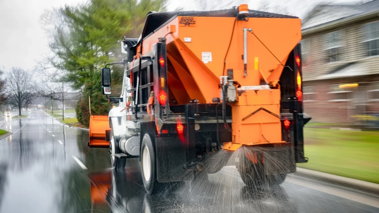
Updated September 21, 2026
A winter-maintenance fleet does its whole year's work in a few dozen nights, and every one of them ends with the same questions: which routes were done, when, and with how much salt. GPS tracking for snow removal answers them from the truck rather than from the operator's log. The Geotab GO device reports every plow's position on the operations centre's live map, and its auxiliary inputs read the plow, the wing and the spreader circuits, so the record of a route shows where the blade was down and where the material was going, block by block. A municipality gets the map it publishes to residents and the record it needs when a council member asks why a street was missed; a contractor gets the proof-of-service its municipal and commercial contracts pay on; and both get the record that defends a slip-and-fall or a collision claim months later. Salt usage per route from the spreader controller, where integrated, feeds the material budget. Engine-hours and PTO-hours maintenance keep trucks that idle all night serviced on the hours they work, electronic DVIR covers the plow and spreader checklist, and driver scoring reflects a heavy truck on a slick road. Off season, the same trucks and the same platform go back to sweeping, hauling and mowing.
Common challenges
- Residents and council asking why a street was not plowed, answered from an operator's memory of the night
- Contract invoices for plowing and salting that the client cannot verify, so payment waits
- Slip-and-fall and collision claims months later with no record of when the road was last treated
- No record of where the plow was down or the spreader was on, only where the truck drove
- Salt spread by feel, with the material budget blown by February
- Trucks that idle through twelve-hour storms and are maintained on mileage that understates the wear
How High Point GPS helps
- Live location of every plow, salt truck, loader and sidewalk machine on one map for the operations centre
- Plow-down, wing-out and spreader-on status read through the GO device's auxiliary inputs, drawn on the route map block by block
- Route-completion reports per storm that show which streets were plowed and treated, when and by which truck
- A public-facing plow map option for municipalities, showing residents which streets have been serviced
- Proof-of-service records for contractors, per site and per visit, with plow and spreader status and the time on site
- Salt and brine usage per route from spreader controllers that integrate, feeding the material budget
- Engine-hours and PTO-hours maintenance, electronic DVIR with the plow and spreader checklist, and fault codes sent to the shop
- Driver scoring for heavy trucks on winter roads, with AI dash cams for the collision review and the fatigue check at hour ten
Where the Blade Was Down
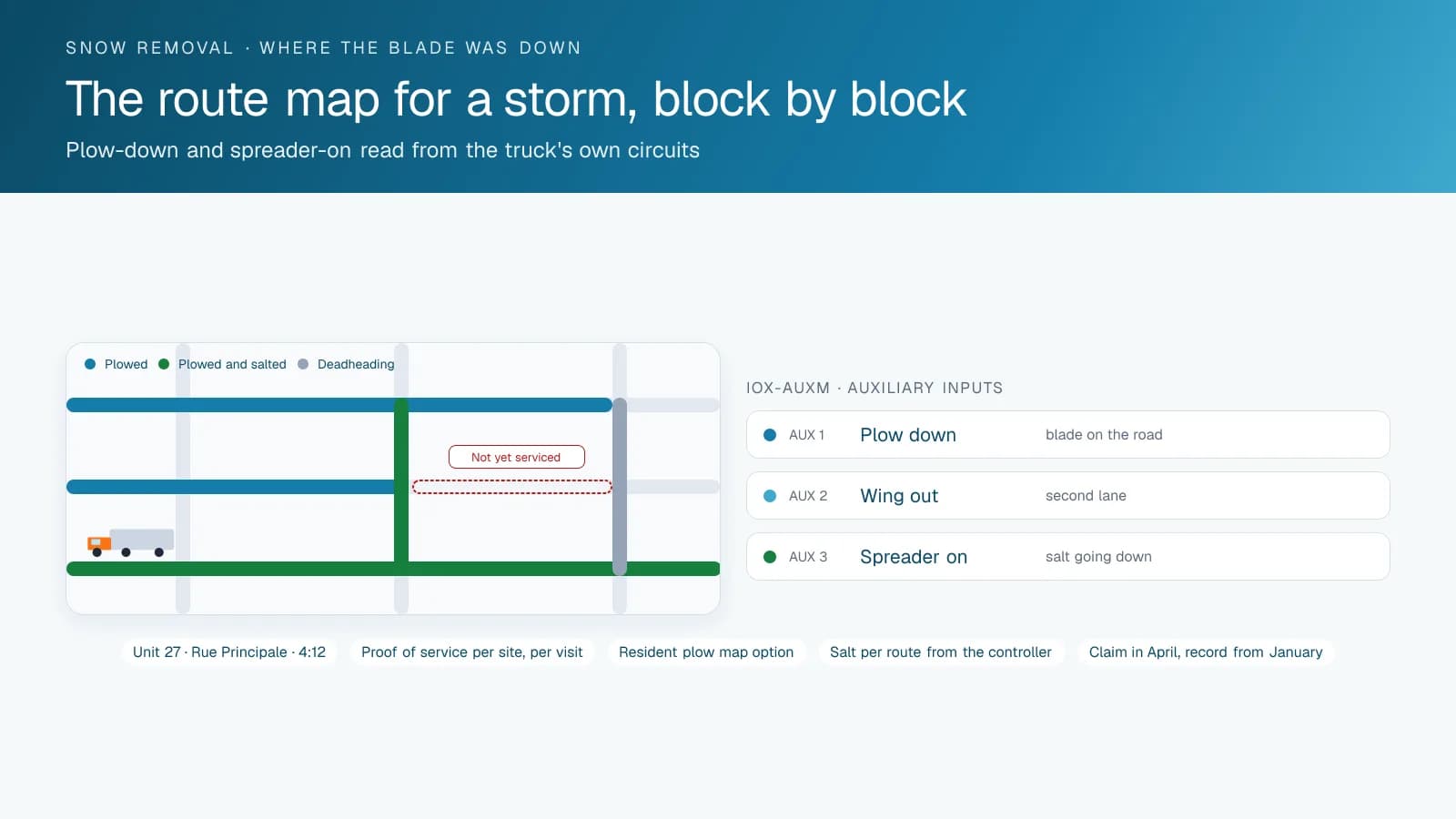
A GPS track shows where the truck went. That is not the same as where it plowed. An IOX-AUXM module on the GO device reads the plow-lift, wing and spreader circuits through the truck's own wiring, so every point on the route carries whether the blade was down and the spreader was on. The route map for a storm draws the plowed segments in one colour, the treated ones in another and the deadheading in a third, and the report behind it lists every street with the time it was serviced and the truck that did it.
That record is what a municipality needs when the phone rings the next morning. The street was plowed at 4:12 by unit 27, the blade was down the whole length, and the spreader was on from the corner. Or it was not, and the operations manager knows before the council meeting rather than during it. Municipalities that want to go further publish a resident-facing plow map from the same data, which cuts the morning calls to the ones that matter.
Proof of Service for Contractors
A snow contractor's invoice says a parking lot was plowed twice and salted once during a storm. The client's property manager was asleep. The platform's record shows the truck inside the site geofence from 1:40 to 2:05 with the blade down, again from 5:10 to 5:30, and the spreader on for the second visit. High Point GPS builds the proof-of-service report to match the contract, per site and per visit, so the invoice goes out with the evidence attached and payment does not wait on a phone call.
The same records answer the claim that arrives in April. A pedestrian fell in the lot on the morning of the storm, or a car slid into a curb; the record shows when the lot was last plowed and salted, by which truck, with the spreader status, and the trip replay shows the truck's path across the lot. For a contractor, that record is the difference between a claim defended and a claim paid.
Salt, Fuel and the Material Budget
Salt is the second-largest line in a winter-maintenance budget and the least controlled. Spreader controllers that integrate with the platform report the application rate and the material used per route, so the operations centre sees which routes and which operators are spreading heavier than the plan. Even without controller integration, the spreader-on time per route from the auxiliary input, multiplied by the set rate, gives a material estimate per storm that the budget can track against.
Fuel follows the same logic. A plow truck idles through a storm, at the yard between routes and at the salt dome while it loads, and the idling report per truck shows where the diesel goes. Fuel-card integration matches the fuel bought to the truck that burned it, per storm and per season.
Maintenance, Inspections and the Off Season
A plow truck may add fifty kilometres to its odometer in a twelve-hour shift and run its engine and hydraulics the whole time. Engine-hours and PTO-hours reminders schedule the hydraulic, engine and spreader-drive service on the hours the truck actually works, and engine fault codes reach the shop as the truck logs them, so a charging or cooling fault is repaired between storms rather than discovered during one. Electronic DVIR in the Geotab Drive app covers the plow, the wing, the spreader and the lights, and a defect reaches the shop before the storm starts.
Driver scoring is set for a heavy truck on a slick road, with hard braking and cornering weighted for winter conditions, and AI dash cams give the road-facing view for the collision review and the driver-facing fatigue detection that matters at hour ten of a shift. When the snow is gone, the same trucks and the same platform go back to sweeping, hauling and mowing, with the plow inputs ignored until November.
Frequently asked questions
Can it tell where the plow was down and the spreader was on?
Yes. An IOX-AUXM module on the GO device reads the plow, wing and spreader circuits, so every point on the route carries that status. The storm map shows plowed, treated and deadheading segments separately, and the report lists each street with its service time.
Can residents see which streets have been plowed?
Yes, if the municipality chooses. A public-facing plow map draws the serviced streets from the same data the operations centre sees, with the detail the municipality decides to publish.
How does it prove service for a contract?
A geofence around each site records arrival and departure per visit, with the plow and spreader status during the visit. High Point GPS builds the proof-of-service report to match the contract, per site and per visit, so it goes out with the invoice.
Does it track salt usage?
With spreader controllers that integrate, yes, per route and per storm. Without controller integration, the spreader-on time from the auxiliary input multiplied by the set rate gives a usable estimate per storm.
What happens to the tracking in summer?
Nothing changes. The same trucks and the same platform carry on with sweeping, hauling and mowing, and the plow and spreader inputs are simply inactive until the equipment goes back on in the fall.
Related solutions
Get a free quote
What are you looking for?