
Industry
GPS Fleet Tracking for Surveying & Engineering Fleets
GPS fleet tracking for surveying and engineering firms: site visits recorded per crew, instruments tracked by truck, and billable field hours you can verify.
Updated September 21, 2026
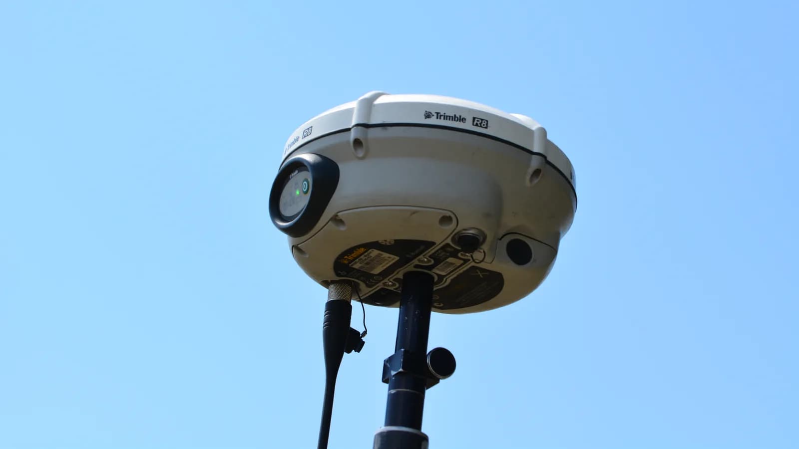
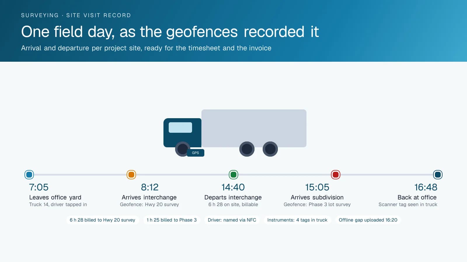
GPS fleet tracking for surveying and engineering firms from High Point GPS records which crew reached which site, when it arrived, how long it stayed and which instruments rode in the truck. It is built for firms that send small crews to many sites, often remote, in trucks carrying instruments worth more than the truck. The project manager knows which jobs were scheduled, and the High Point GPS platform fills in the rest on one live map of every truck and crew. Geofences around each project site produce an arrival and departure record that goes straight into the timesheet and the client invoice. Bluetooth asset tags on GNSS receivers, total stations, scanners and drones show which instrument is in which truck, and raise an alert when a case leaves the vehicle away from a site or the office. The IOX-NFCREADERA driver ID reader attributes each trip to a named employee, which you need when engineers, technicians and summer students share the same vehicles. On field days with no cellular coverage, the GPS tracking device stores the trips and uploads them when the truck returns to range. Engine-hours maintenance reminders and fault codes keep long-distance trucks off the shoulder, and driver scoring protects the firm's insurance record and its reputation at client sites. When a client questions a site visit, you answer with the trip replay and the geofence record.
Common challenges
- Field hours on a timesheet that cannot be matched to a site, so a client disputes the invoice and the firm has nothing to show
- Instruments worth tens of thousands of dollars riding in the back of a pickup, with no record of which truck they are in
- Shared trucks driven by engineers, technicians and students, and no way to know who was at the wheel on a given trip
- Sites without cellular coverage, where the office loses sight of the crew for the whole day
- Mileage claims and project cost allocations rebuilt by hand from memory at month end
- Long highway runs on aging trucks, where one breakdown strands a crew and a day of scheduled work
How High Point GPS helps
- Live map of every survey truck and field crew, with project sites drawn as geofences beside them
- Arrival and departure records per project site that feed the timesheet and the invoice line with no manual entry
- Bluetooth asset tags on total stations, GNSS receivers, scanners and drone cases, showing which instrument rode in which truck
- Alerts when a tagged instrument leaves a vehicle anywhere other than a project site or the office
- A named driver on every trip through the IOX-NFCREADERA reader, for shared vehicles and pool trucks
- Trips recorded offline on the GPS tracking device where there is no coverage, and uploaded when the truck returns to range
- Mileage per project and per client from the trip history, ready for cost allocation and expense reimbursement
- Engine-hours maintenance reminders and fault codes for trucks that spend their week on the highway
How does GPS tracking turn a site visit into a record a client can check?
High Point GPS draws a geofence around each active project site, and the platform writes an arrival and departure record every time a truck enters and leaves it. For a firm whose revenue is field time, that record is the proof. The crew chief stops rebuilding the day from memory: the timesheet shows 8:12 to 14:40 at the highway interchange survey and 15:05 to 16:30 at the subdivision, with the driving in between. At month end the project manager pulls the site-visit report by client and by project, and the invoice line carries the same times the client's site superintendent saw the truck arrive.
A disputed bill then takes minutes to settle. The trip replay shows the truck on the access road, stopped at the control point for three hours, and the drive back. If a crew was sent back because the site was not ready, the record shows the short visit and the second trip, and the firm bills both. On public-sector contracts, the same records can help answer an auditor who asks whether the hours on the invoice match the hours on the ground, and a project manager can use the replay with a client who asks why a survey took longer than quoted.
Protecting the instruments as well as the truck
A survey truck carries a total station, a GNSS base and rover, a scanner, a drone and the tripods and prisms that go with them. The insurance claim after a theft is painful; the lost field days while replacements arrive are worse. Bluetooth asset tags, supplied and installed by High Point GPS, go on each instrument case, and the GPS tracking device in the truck reports which tags it can see. The High Point GPS platform shows the total station in truck 14 at the office yard, and it shows the moment the scanner case stopped travelling with the truck. A rule raises an alert when a tag separates from its vehicle anywhere other than a project geofence or the shop.
The same tags answer the Monday-morning question of where the equipment went. A technician swapped the rover into another truck on Friday; the tag history shows which one. An instrument is due for calibration; the report shows which truck has it and where that truck is. For high-value items that travel between trucks and stay on site overnight, a battery-powered tracker reports position on its own, so the firm sees the instrument even when no vehicle is near it. The report also lists tags not seen for a set number of days, which catches a case left at a site before the client does.
Who drove, where, and on whose project
Engineering firms run pool vehicles. An engineer takes a truck to a site inspection on Tuesday, a technician takes the same truck to a survey on Wednesday and a co-op student takes it to pick up supplies on Thursday. The IOX-NFCREADERA reader on the dash attributes each trip to the person who tapped in, and the High Point GPS platform reports mileage by driver, by vehicle and by the project geofences the trip visited. The finance team allocates vehicle cost to projects from the report rather than from a mileage log that half the staff forgot to fill in.
Driver scoring becomes useful for the same reason. A firm's trucks carry its name to client sites and municipal rights-of-way, and a truck seen speeding through a subdivision under construction reflects on the firm. Speed limits per geofence, hard-braking and cornering events and seatbelt use are reported by named driver, and a supervisor coaches from a specific trip rather than a general reminder. Personal-use rules let staff who take a truck home keep after-hours driving separate from project mileage. The reports go to the safety file that the firm's insurer reviews at renewal.
Remote sites, long drives and trucks that have to make it back
Survey work goes where the coverage does not. The GPS tracking device keeps recording position, speed and engine data when the truck leaves cellular range, stores the day's trips on the device and uploads them the moment it reconnects. The office sees the crew's last known position during the day and the complete trip history that evening, with the site geofence records intact. Rules such as a check-in expected by a set hour let a manager notice a crew that has not reappeared, which matters for a two-person team working a forestry road.
The trucks themselves take a beating: gravel roads, long highway days and weeks of idling with equipment running off the cab. Maintenance reminders keyed to engine hours and mileage schedule service before a long project rather than during it, and engine fault codes reach the shop when the truck logs them, often before the driver notices anything. High Point GPS sets the reminders to the firm's own intervals and, for trucks that live on rough access roads, installs the rugged GPS tracking device unit built for it. Trip and idling data also show which trucks are underused and could be shared between offices.
Frequently asked questions
Can survey site-visit records be used for client invoicing?
Yes. Geofences around each project site produce an arrival and departure record for every visit, with the times, the vehicle and the driver. You pull the report by client or by project and it matches the invoice line. If a client asks for more detail, the trip replay shows the truck's route and stops for that day.
How does it track instruments like total stations and GNSS receivers?
Bluetooth asset tags go on each instrument case, and the GPS tracking device in the truck reports which tags it can see. The High Point GPS platform shows which instrument is in which truck and sends an alert when a tag leaves a vehicle away from a site or the office. Battery-powered trackers cover items left on site.
Will it work at sites with no cell coverage?
Yes. The GPS tracking device stores trips, stops, speed and engine data in its own memory when coverage drops, then uploads everything when the truck returns to range. The site geofence records are kept, and the office sees the full day once the truck reconnects. Rules and alerts run as soon as the data arrives.
How do we know who was driving a shared truck?
An IOX-NFCREADERA reader on the dash attributes each trip to the employee who tapped their card or fob. Trips, mileage, safety events and site visits are then reported by driver as well as by vehicle, so firms with pool trucks can allocate cost and coach driving. Personal-use rules keep after-hours trips separate from project mileage.
Can vehicle cost be allocated to projects?
Yes. Mileage and time per trip are tied to the project geofences the trip visited, and the High Point GPS platform reports them by project, client, vehicle and driver. Finance pulls the allocation at month end from the report, with no handwritten logs, and the same data supports expense reimbursement. Reports export to accounting through the API.
Related solutions
Related guides
- What Is Geofencing? How It Works in Fleet Tracking →
- Asset Tracker Tags vs. Powered GPS Trackers for Equipment →
- Bluetooth Asset Tracking Tags and the IOX-BT: How They Work and What to Tag →
- IOX-NFCREADERA: Driver ID by NFC Tap, So Every Trip Has a Name on It →
- Heavy Equipment Theft Recovery: How GPS Gets Stolen Machines and Trailers Back →
- Fleet Maintenance Schedule: Engine Hours vs Calendar and Mileage →
Get a free quote
- Over 500 fleets
- Since 2013
- 4.9 on Google (19 reviews)
What are you looking for?
Prefer to talk?Call 1-800-613-6323[email protected]