
Industry
GPS Fleet Tracking for Agriculture & Farm Fleets
GPS tracking for farm fleets, custom operators and agricultural suppliers that keeps trucks, tractors, sprayers and grain carts on one map, records the hours each machine actually works, and turns field time into the billing and maintenance records the operation runs on.
Updated September 21, 2026
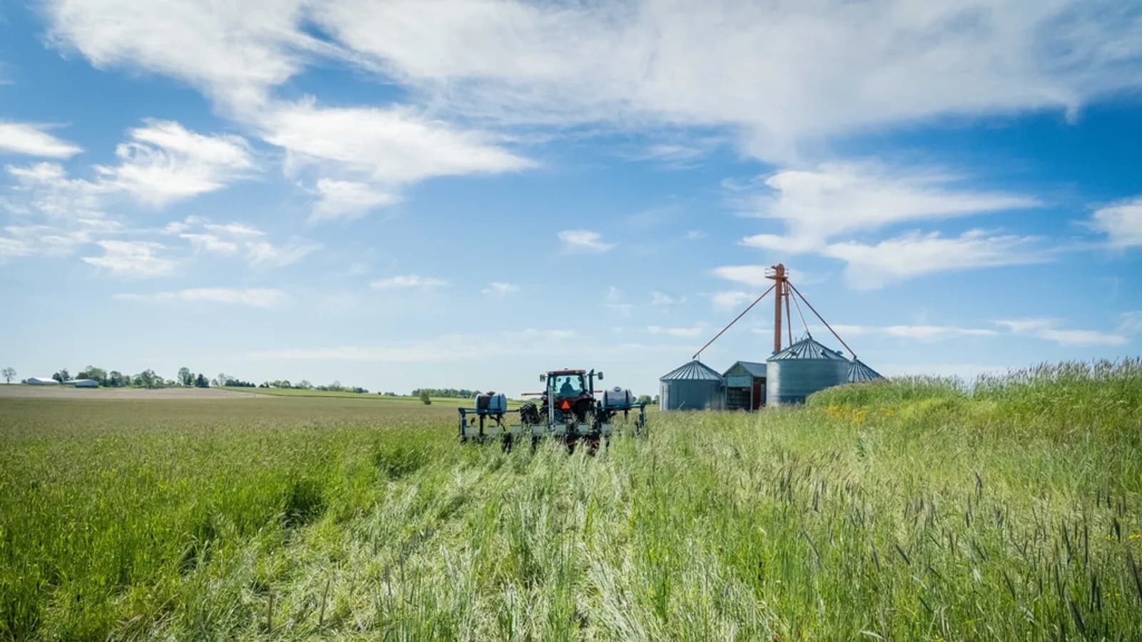
A farm fleet is the most mixed fleet there is: pickups and grain trucks on the road, tractors, combines and sprayers in the field, and trailers, tanks and implements that move between them. GPS tracking for agriculture puts all of it on one map, on-road and off, so the operator knows where the grain cart is when the combine fills, which truck is at the elevator and which is still on the gravel, and whether a sprayer left a field it was not supposed to be in. The Geotab GO device on the trucks reads engine data and hours; on tractors and combines it reads the CAN bus where available and, through auxiliary inputs, the PTO and implement engagement that say whether a machine was working or just idling in a headland. Geofences around each field turn a day's movement into time-per-field, which is what a custom operator bills on and what a farm uses to cost each crop. Battery-powered trackers on trailers and implements answer the question of where the auger or the anhydrous tank was left. Maintenance runs on engine hours, and the hours-of-service exemptions that apply to agricultural hauling are set up correctly for the trucks that cross into regulated distance during harvest.
Common challenges
- Trucks, tractors and implements spread across fields and yards with nobody sure where the grain cart or the sprayer is
- Custom-work invoices based on estimated field hours that the customer disputes
- No record of which field a machine was in, for how long, or whether the PTO was engaged
- Trailers, augers and tanks left in a field and searched for at the start of the next job
- Combines and tractors maintained by the calendar while engine hours pile up in a six-week season
- Grain trucks hauling past the agricultural hours-of-service exemption radius during harvest with no log to show
How High Point GPS helps
- Live location of trucks, tractors, combines and sprayers on one map, on-road and in the field
- Field geofences that record time per field per machine, for custom-work billing and crop costing
- PTO and implement engagement read through the GO device's auxiliary inputs, separating working time from idle time
- Battery-powered trackers and Bluetooth tags on trailers, augers, tanks and implements that have no power of their own
- Engine-hours maintenance reminders and fault codes from the CAN bus on the machines that report them
- Fuel-use and idling reports per machine and per field, with fuel-card integration for the road trucks
- Agricultural hours-of-service exemptions configured in the Geotab Drive app for the trucks that need an ELD at harvest
- After-hours movement alerts and geofence alarms for theft of fuel, machines and equipment from remote yards
One Map for the Road and the Field
The difference between a farm fleet and any other is that half of it never sees pavement. The Geotab GO device on the grain trucks and pickups reports the same position and engine data it would in any fleet. On tractors, combines and self-propelled sprayers, High Point GPS installs the GO device with a harness suited to the machine, so the same map shows the combine in the field, the grain cart beside it and the truck on the road to the elevator. Trailers, augers, seed tenders and anhydrous tanks with no power of their own carry a battery-powered tracker or a Bluetooth tag that reports through whichever tractor or truck is nearest.
During harvest that map is the operation's dispatch board. The combine operator sees where the empty cart is, the truck driver sees whether the pile at the field edge is ready, and the manager sees which fields are done and which machines are stopped. The same map answers a February question about where a piece of equipment was left, without anyone driving out to look.
Time per Field, Hours per Machine
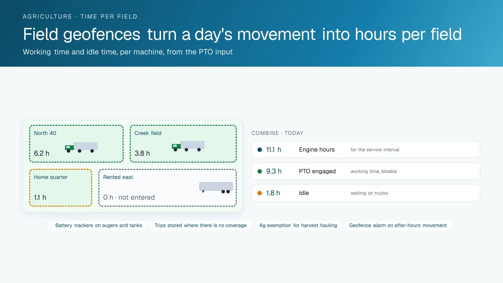
A geofence drawn around each field turns the day's movement into a record: which machines entered, when, and for how long. For a custom operator, that is the invoice, and it is one the customer can be shown on a map rather than argued about. For a farm, it is the cost of each crop in machine hours, fuel and labour, field by field, which is the number that decides what gets planted next year.
The PTO or implement input on the GO device separates the hours that count from the ones that do not. A tractor idling at the field edge while the operator waits for a truck is engine time, not working time, and the record shows both. Sprayer operators use the same record to show which fields were sprayed and when, which is a compliance question as much as a billing one.
Maintenance in a Six-Week Season
A combine may run 300 engine hours in six weeks and then sit for ten months. Calendar-based maintenance misses both halves of that pattern. Engine-hours reminders from the GO device schedule the service intervals as the hours accumulate, and on machines that report through the CAN bus, fault codes reach the manager's phone as the machine logs them. A charging or hydraulic warning caught in the field at noon is a part ordered for tomorrow; the same warning ignored is a combine down in the best week of the harvest.
The road trucks are maintained the same way, with mileage and engine hours together, and a pre-trip inspection in the Geotab Drive app for the trucks that carry a driver on the highway. Fuel-card integration matches the fuel bought to the truck that burned it, and idling reports show where the diesel goes when the truck is not moving.
Harvest Hauling, Hours of Service and Theft
Agricultural hauling has its own hours-of-service exemptions in both Canada and the United States, tied to distance from the farm and to the season, and a grain truck that crosses that line during harvest needs a log. The Geotab Drive app supports the agricultural exemptions, so the driver records the exempt miles as exempt and the regulated ones properly, and the record is there if the truck is stopped at a scale. High Point GPS sets the exemption up for the trucks and drivers it applies to and leaves the rest of the fleet out of it.
Remote yards and fuel tanks are targets, and a machine parked at a field edge is one too. Geofence alarms report when a machine or a tagged implement leaves the yard outside working hours, and the tracker keeps reporting as it goes, which is how stolen equipment comes back. Fuel-level data from the trucks that report it, matched against the fuel bought, shows a tank that is being drained on the weekend.
Frequently asked questions
Does it work on tractors and combines, not just trucks?
Yes. High Point GPS installs the GO device on tractors, combines and self-propelled sprayers with a harness suited to the machine, reading position, engine hours and, where the machine supports it, CAN bus data and fault codes. PTO and implement engagement are read through auxiliary inputs.
Can it track implements and trailers that have no power?
Yes. Battery-powered trackers and Bluetooth asset tags go on trailers, augers, seed tenders and tanks. The tags report through whichever tracked tractor or truck is nearby, and the battery trackers report on their own schedule, so the platform shows where each was last seen.
How does time per field work for custom-work billing?
A geofence around each field records which machines entered, when and for how long, with PTO engagement separating working time from idle time. That record is the invoice, and it can be shown to the customer on a map.
Do our grain trucks need an ELD at harvest?
Sometimes. Agricultural exemptions in both countries cover hauling within a set distance of the farm during the season, and a truck that goes beyond that needs a log. The Geotab Drive app supports the exemptions, and High Point GPS sets them up for the trucks and drivers they apply to.
Will it work where there is no cell coverage?
The GO device stores its data and uploads it when coverage returns, so the field record is complete even where the map went dark. Live position is only as current as the last upload, which in most farming areas is continuous.
Related solutions
Related guides
- Fleet Maintenance: Engine Hours vs. the Calendar →
- GPS Asset Tags vs. Powered Trackers: Which to Use →
- Trailer GPS Tracking: How to Track Trailers With and Without a Truck Attached →
- Equipment Theft Recovery: How GPS Gets Stolen Machines and Trailers Back →
- FMCSA ELD Exemptions: Does Your Fleet Need One? →
- How Geofencing Works for Fleet Tracking →
Get a free quote
What are you looking for?