
Industry
GPS Fleet Tracking for Flatbed & Specialized Hauling
GPS fleet tracking for flatbed and heavy-haul carriers: permit-route corridors, job-site pickup and delivery records, and a trailer pool on one map.
Updated September 21, 2026
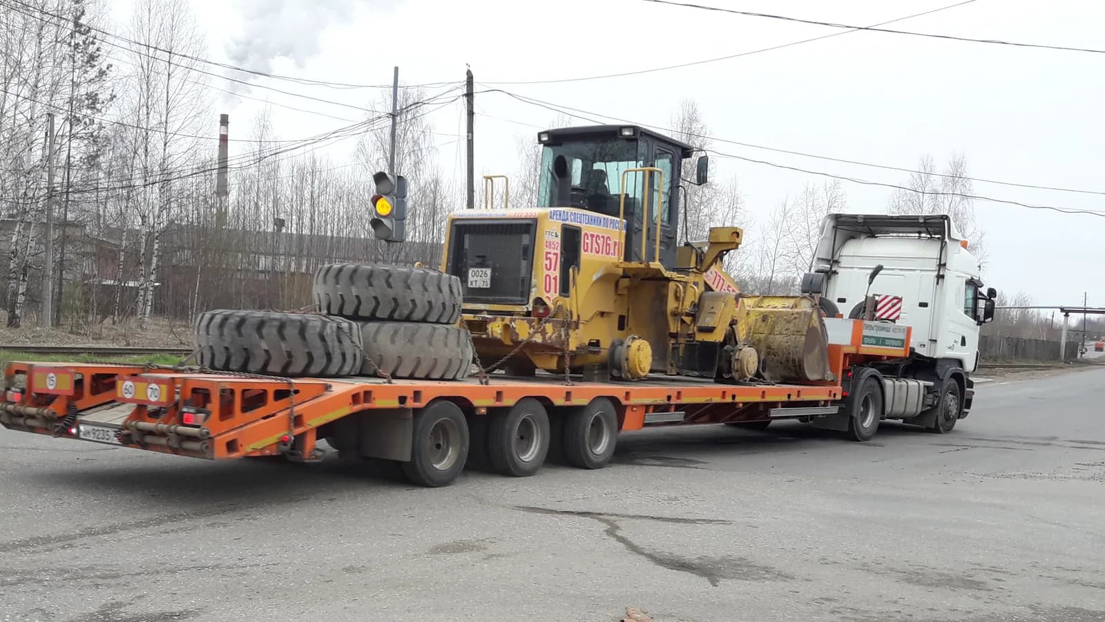
Flatbed and specialized hauling is trucking with more variables: open loads, tarps and chains, job sites instead of docks, permits that dictate the route and the hours a load may move, and trailers that range from a 48-foot flat to a multi-axle lowboy. High Point GPS builds the carrier's operation on the High Point GPS platform so that the office sees every tractor and every trailer on one map. The driver's remaining hours sit beside each truck, and the trailer is paired to the trip that moved it. Permit routes for oversize and overweight loads are drawn as geofence corridors, with the permitted travel window as a rule. A truck that leaves the corridor or moves outside the window raises an alert while there is still time to correct it. Job-site geofences write the arrival, the loading or unloading time and the departure for each pickup and delivery. That is the record behind a detention claim and the answer to a customer asking where the steel is. Electronic DVIR carries the securement and trailer items, hours of service and IFTA come from the same GPS tracking device, and asset trackers on the trailer pool show where every flat, step-deck and lowboy sits. Driver scoring is set for a high, open load, and AI dash cams capture the road for the moments an insurer will ask about.
Common challenges
- Oversize loads that leave the permitted route or move outside the permitted hours, discovered from a citation weeks later
- Job-site pickups and deliveries with no timestamp, so detention at a mill or a construction site cannot be billed
- Trailers of different types scattered across yards and job sites, with dispatch unsure which lowboy is free
- Securement inspections on paper, with no record that the tie-downs were checked at the required interval
- Customers calling for a load's location on a project timeline, and a dispatcher who has to call the driver
- Hours-of-service planning for multi-day heavy hauls with escort vehicles and daylight-only windows
How High Point GPS helps
- Every tractor and trailer on one live map, with the driver's remaining hours beside each truck
- Permit-route corridors and travel-window rules for oversize and overweight loads, with alerts on deviation
- Job-site arrival, loading time and departure from geofences, for detention and customer status
- Asset trackers on flats, step-decks and lowboys, showing which trailer is free and where
- Trailer paired to the tractor on each trip, so the trip record shows which trailer moved which load
- Electronic DVIR with securement and trailer inspection items in the driver app
- ELD hours of service under US and Canadian rules, planned around daylight-only permit windows
- Driver scoring set for a high, open load and AI dash cams for the events that end up in a claim
Keeping an oversize load on its permit
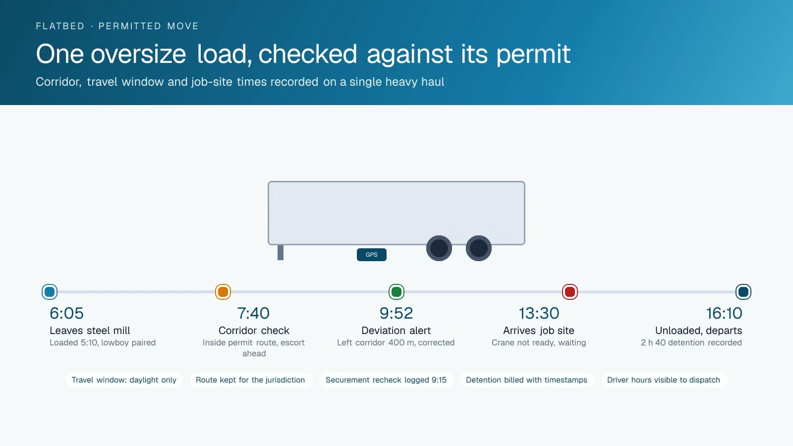
A permit is a contract with a jurisdiction: this route, these hours, this escort. High Point GPS draws the permitted route as a geofence corridor in the High Point GPS platform and sets the travel window as a rule, and the truck is checked against both as it moves. A driver who takes a shortcut, or who is still rolling ten minutes after the permitted end of daylight travel, produces an alert to dispatch while the correction is a phone call rather than a citation. The trip record shows the route and the times for every permitted move, kept for as long as the carrier wants it.
That record is what the carrier hands over when a jurisdiction, a customer or an insurer asks. A bridge strike or a damage claim on a route the load never took is answered with the trip replay. A customer who wants to know the transformer moved as planned sees the route, the stops and the arrival. For multi-day heavy hauls, the same view shows the load's overnight parking and the escort vehicles alongside it when they carry a GPS tracking device of their own. Permit numbers can be attached to the trip for the file.
Job sites, mills and the detention nobody billed
Flatbed loads come from steel mills, lumber yards and pipe yards and go to job sites where the crane is not always ready. A geofence around each pickup and delivery point records the arrival, the time inside and the departure, with the driver and the trailer attached. A truck that waited three hours at a job site for a crane produces a record that shows it, and the detention line on the invoice carries the timestamps. A dispatcher answering a customer's status call reads it from the map. The same record shows a mill that loaded the truck in twenty minutes.
Dwell by customer and by site tells a manager where the fleet is losing hours, which is the figure behind the next rate discussion with a shipper whose yard takes ninety minutes to load a flat. Multi-stop flatbed runs show each stop in sequence with the time at each, and the customer who receives a partial load sees when it arrived. High Point GPS sets up the site geofences from the dispatch record and feeds the arrival and departure events to the carrier's TMS through the open API where the carrier wants them there.
A trailer pool of flats, step-decks and lowboys
A specialized carrier's trailers are not interchangeable, and the wrong one at the wrong yard costs a day. Asset trackers on every trailer show each flat, step-deck, double-drop and lowboy on the map, at the yard, at a customer's site or behind a tractor. The tractor's GPS tracking device pairs with the trailer it is pulling, and the trip record shows which trailer moved which load. When dispatch needs a lowboy for a Monday excavator move, the map shows which ones are free and where, rather than a phone call to three drivers.
Dwell reports by trailer show which units have sat at a job site for a week and should be retrieved or billed, and which have been at a lot long enough to be a theft risk. A geofence rule raises an alert when a trailer leaves a yard after hours or without a fleet tractor attached. Trailer trackers report on their own power from a job site with no tractor in sight, which is how a carrier finds a step-deck left behind at a project that closed for the winter.
Securement, hours, driving and the claim file
Securement is the inspection regulators check hardest on a flatbed. The electronic DVIR in the driver app carries the carrier's securement checklist, and the en-route recheck items are recorded with a timestamp when the driver completes them at a stop. Defects on the trailer, the tarps or the tie-downs are routed to the shop, and the inspection record is on file for the required period. Hours of service run in the same app under US or Canadian rules, and the driver's remaining hours are visible to dispatch when planning a haul that can only move in daylight.
A high, open load changes how a truck should be driven. Driver scoring is configured for it: cornering thresholds for a load with a high centre of gravity, hard-braking events that shift a load against its chains and speed rules per zone for the ramps and site roads where it matters. AI dash cams capture the road and the cab when an event occurs, and a claim about a load that shifted or a vehicle that was struck is answered with footage, speed and position from one record. Engine fault codes and engine-hours reminders keep the tractors maintained between hauls.
Frequently asked questions
Can it enforce a permit route and travel window?
Yes. The permitted route is drawn as a geofence corridor and the travel window is set as a rule, and dispatch is alerted the moment a truck leaves the corridor or moves outside the window. The route and times for every permitted move are kept in the trip history for jurisdictions and customers.
How does it record time at a job site or a mill?
A geofence around each pickup and delivery point records the arrival, the time inside and the departure, with the driver and trailer attached. That record supports detention billing, answers customer status calls and shows a manager which sites and customers are costing the fleet hours. Events can be pushed to the TMS through the API.
Can it track different trailer types separately?
Yes. Asset trackers on every flat, step-deck, double-drop and lowboy report position on their own, and the High Point GPS platform shows each trailer by type at a yard, a job site or behind a tractor. The trailer pairs with the tractor on each trip, and dwell reports and after-hours alerts cover trailers left behind.
Does the DVIR include securement checks?
Yes. The electronic inspection in the driver app carries the carrier's securement checklist, and en-route recheck items are recorded with a timestamp when the driver completes them. Defects on the trailer, tarps or tie-downs are routed to the shop, and the records are kept for the required period.
Is driver scoring adjusted for flatbed loads?
Yes. High Point GPS sets cornering, hard-braking and per-zone speed thresholds for a high, open load rather than using generic settings. Events are reported by driver with the location and speed, and AI dash cams capture road and cab video for the ones that could end up in a claim.
Related solutions
Related guides
- Trailer GPS Tracking: How to Track Trailers With and Without a Truck Attached →
- How Geofencing Works for Fleet Tracking →
- Detention Time: What It Is, What It Costs, and How to Bill It With GPS Evidence →
- Hours of Service Rules Explained: The 11 and 14 Hour Limits →
- High Point GPS DVIR: How Digital Vehicle Inspection Reports Work →
- Dash Cam Footage and Insurance Claims →
Get a free quote
What are you looking for?