
GPS Fleet Tracking & Telematics
What Is GeoDocs? Fleet Document Management Inside the High Point GPS Platform
GeoDocs is fleet document management in the High Point GPS platform: it stores vehicle and driver documents and sends reminders before they expire.

What Is GeoDocs, and What Problem Does It Solve?
GeoDocs is a document repository inside the High Point GPS platform that attaches each file to the vehicle or driver it belongs to and tracks its expiry date. It solves the glovebox problem. Each fleet vehicle carries documents that expire: registration, insurance card, IFTA licence copy, cab card, permits and inspection certificates. Each driver carries another set, including a licence, a medical certificate and training records. Those papers sit in gloveboxes, filing cabinets and a shared drive with folders named by whoever set it up, and fleets find out one has lapsed at a roadside inspection or during an audit.
What Does GeoDocs Store, and Where Does It Show Up?
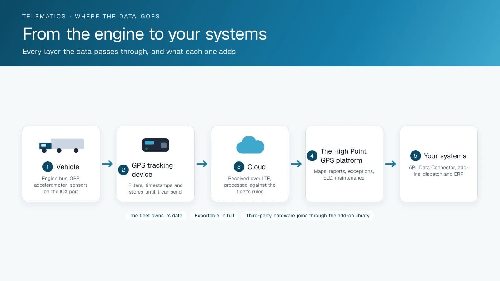
GeoDocs holds vehicle documents (registrations, insurance, permits, warranties, manuals and standard operating procedures) and driver documents such as licences, certifications and onboarding paperwork. As an add-in, it appears as a page inside the High Point GPS platform with no separate login, and the documents show against the same vehicles and drivers the rest of the platform uses. A manager looking at a truck sees its documents beside its trips and DVIRs. A driver at a roadside stop can pull up the registration and insurance card in the driver app instead of digging through the cab.
The expiry reminders do most of the work. Each document carries a date, and the add-in sends a notification before it lapses, so the insurance renewal and the permit reapplication happen on schedule instead of at the scale.
How Does GeoDocs Help With an Audit?
IFTA and IRP audits, FMCSA compliance reviews in the US, National Safety Code facility audits in Canada and insurer inspections all open with a document request. If you can export the current registration, cab card and inspection certificate for each unit from one screen, you can answer in an hour. The same repository holds the SOPs and training records an auditor uses to judge your safety program, so the proof that a driver was trained on the DVIR procedure sits next to the DVIRs that driver filed.
Which Documents Should You Load First?
You don't need every file on day one. Start with the documents that close out inspections and audits fastest, and track the expiry each one carries.
| Document | Attached to | Expiry to track |
|---|---|---|
| Registration and cab card | Vehicle | Registration year end |
| Insurance certificate | Vehicle or fleet | Policy renewal |
| Annual safety inspection certificate | Vehicle | Inspection due date |
| IFTA licence copy | Fleet, shown per vehicle | December 31 |
| Permits: HUT, KYU, oversize | Vehicle | Per permit |
| Driver licence and endorsements | Driver | Licence expiry |
| Medical certificate | Driver | Certificate expiry |
| Training records and SOPs | Driver or fleet | Refresher date |
How Do You Set Up GeoDocs?
GeoDocs is a custom add-in built by High Point GPS, and High Point GPS installs it into your fleet's High Point GPS platform database. Set permissions so drivers see their own documents and managers see everything, then upload the existing files against each vehicle and driver with their expiry dates. The upload is the only real work, and how long it takes depends on how many units and documents you load. High Point GPS sets up add-ins like this as part of a deployment, and builds custom ones when a fleet's document workflow needs something the library lacks.
Frequently asked questions
What is GeoDocs?
GeoDocs is a High Point GPS platform add-in that stores vehicle and driver documents, including registrations, insurance, permits, manuals, licences and training records. Each file is attached to the vehicle or driver it belongs to, and the add-in sends a reminder before a document expires, so your team renews it before an inspection turns up the gap.
Is GeoDocs a separate system from the High Point GPS platform?
No. GeoDocs is an add-in, so it appears as a page inside the High Point GPS platform and uses the same vehicles, drivers and logins as the rest of the platform. A manager sees a truck's documents beside its trips and DVIRs.
Can drivers see documents on the road?
Yes. A driver can open the vehicle's registration and insurance card in the driver app during a roadside stop instead of digging through the glovebox. Permissions decide what each person sees: drivers see their own documents, and managers see everything stored for the fleet.
Does GeoDocs warn before a document expires?
Yes. Each document in GeoDocs carries an expiry date, and the add-in sends a notification before that date arrives. Your team can then handle the insurance renewal or the permit reapplication on schedule, instead of finding a lapsed document at a roadside inspection.
Where do I get GeoDocs?
GeoDocs is a custom add-in built by High Point GPS and listed on the Geotab Marketplace; High Point GPS sets it up in your platform database as part of a deployment and supports it. High Point GPS can also build a custom add-in if your document workflow needs something GeoDocs doesn't offer.
Related solutions & products
Related terms
Continue reading
- GPS Fleet Tracking & Management Software overview →
- How to Send Documents to Drivers With GeoDocs in MyGeotab →
- What Does a Geotab Partner Do? Installation, Setup, Support and Add-Ins →
- What Is Geotab? The Company, GO Devices, MyGeotab and the Marketplace →
- Fleet API Explained: What You Can Build With High Point GPS →
- More in GPS Fleet Tracking & Telematics →
Get a free quote
- Over 500 fleets
- Since 2013
- 4.9 on Google (19 reviews)
What are you looking for?
Prefer to talk?Call 1-800-613-6323[email protected]