
GPS Fleet Tracking & Telematics
Public Tracking Portal: Giving Customers and Residents a Live Map Without a MyGeotab Login
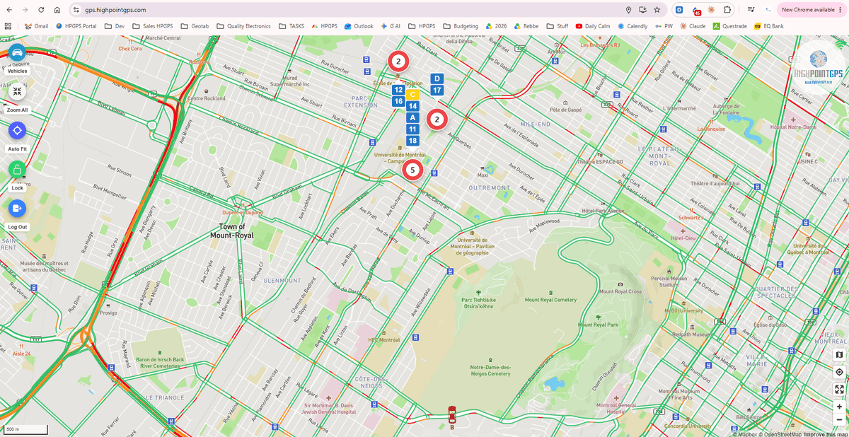
A customer asking where the truck is, a resident asking whether the plow has passed, a school asking where the bus is: all three want a map, and none of them should have a login to the fleet's platform. The Public Tracking Portal publishes a scoped, read-only view of chosen vehicles on a page the fleet controls. Here's what it shows and who uses it.
The Phone Call It Replaces
Every fleet fields the same call: where is it. A customer waiting for a delivery, a contractor waiting for a concrete truck, a resident on a snow day, a parent at a bus stop. The dispatcher looks at MyGeotab and reads the answer aloud, twenty times a morning. The Public Tracking Portal is a web page, built by High Point GPS on the Geotab API, that shows the same answer to the people asking, scoped to exactly the vehicles and information the fleet chooses, with no login and no access to anything else.
What the Fleet Controls
The fleet decides which vehicles appear — a group, a route, a single truck for a single customer — and what is shown: position and direction, an ETA to a geofenced destination, the streets a plow has covered today, a bus's progress along its stops. It decides whether the page is open to anyone, protected by a link, or embedded in the fleet's own website or a customer's. Driver names, other vehicles, history and anything else in the platform stay invisible. The page carries the fleet's branding, not Geotab's.
Who Uses It
Municipalities publish plow and sweeper coverage during winter operations, which cuts the call volume that otherwise floods the public works line. Delivery and distribution fleets give key accounts a link to the truck on their route. Ready-mix and aggregate suppliers show a contractor the trucks headed to the site. School bus operators use a version of it as the parent view. In each case the phone stops ringing for the question the page answers.
Setting It Up
The portal reads the fleet's MyGeotab data through the API with a restricted service account, so the fleet's own permissions are never exposed. High Point GPS configures the vehicle scope, the fields shown and the access model, applies the fleet's branding, and hosts the page or hands it to the fleet's web team to embed. Changes to which vehicles appear are made in MyGeotab groups, not in code.
Frequently asked questions
What is the Public Tracking Portal?
A read-only web page, built on the Geotab API, that shows chosen vehicles to customers or the public without a MyGeotab login, scoped and branded by the fleet.
Can it show snowplow coverage?
Yes. Municipalities use it to publish which streets the plows have covered during winter operations.
Does it expose driver names or history?
No. Only the vehicles and fields the fleet chooses are shown; everything else stays inside the platform.
Can it be embedded in our website?
Yes. It can be hosted as a standalone page, protected by a link, or embedded in the fleet's or a customer's site.
How are vehicles added or removed?
By changing the MyGeotab group the portal reads, with no code changes.
Related solutions & products
Related terms
Continue reading
- GPS Fleet Tracking & Management Software overview →
- Bus Route Progress: The MyGeotab Add-In That Shows Which Buses Are On Route, Late or Parked →
- DIDCOM Passenger ID: Recording Every Student or Employee Boarding With a Card Tap →
- GPS Fleet Tracking for Waste and Recycling Fleets: Proof of Service, Routes and Hydraulics →
- Do School Buses Have GPS? How School Bus Tracking Works for Districts and Parents →
- More in GPS Fleet Tracking & Telematics →
Get a free quote
What are you looking for?